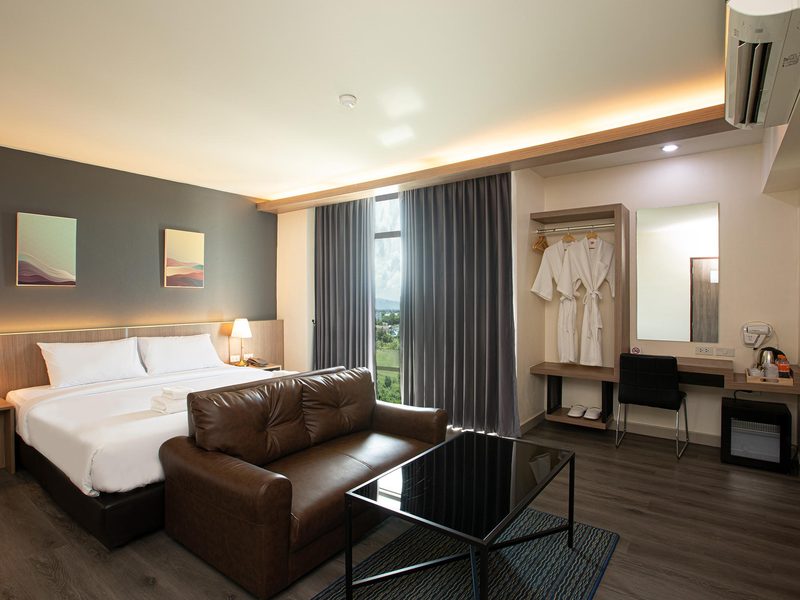
Things to Do in Mae Sot in May
May weather, activities, events & insider tips
Low Season · Budget Friendly
May Weather in Mae Sot
Long-run averages for May
94°F (34°C)
High Temp
75°F (24°C)
Low Temp
6.0 inches (152 mm)
Rainfall
79%
Humidity
12
Sunny-Day UV
⚠ The transition into monsoon season brings a sharp increase in mosquito populations as standing water accumulates. Dengue fever risk rises through May and peaks in the following months. Use strong repellent. Sleep under treated nets where provided. Seek medical attention promptly for sudden high fever. Do not delay.
⚠ Flash flooding occurs along the Moei River and in low-lying areas of Mae Sot during heavy downpours. Streets near the river and the border market area can flood within an hour of sustained rain. Avoid river banks during and immediately after storms. Stay safe.
⚠ Highway 1090 to Umphang gets worse through May. Rain softens shoulders. Visibility drops on blind mountain curves. Landslide risk climbs on steeper sections. Check conditions locally before you leave. Do not attempt this route on a motorbike without serious mountain riding experience.
Making the most of May in Mae Sot? Browse tours and activities in Mae Sot on GetYourGuide.
Is May Right for You?
Weigh the advantages and considerations before booking
Advantages
- + The burning season smoke that chokes northern Thailand from February through April has finally been washed out by the first rains, and Mae Sot's air quality in May is the cleanest it has been in months. You can see the Dawna Range rising sharply across the Moei River into Myanmar, its ridgeline no longer smudged behind haze. After weeks of breathing acrid particulate, this alone is reason to time a visit now.
- + May sits in the gap between the scorching 37°C (99°F) highs of April and the relentless downpours of July and August, when Tak Province receives over 370 mm (14.6 inches) in a single month. The temperature has dropped to a more tolerable 34°C (94°F), and the rains that do arrive tend to come in sharp afternoon bursts that cool the valley noticeably. You get the green without the deluge.
- + Tourist traffic in Mae Sot is thin at the best of times. But in May it drops to almost nothing. The guesthouses along Intharakiri Road that fill during the cool season with NGO workers and border-crossing day-trippers have vacancies. You will likely be the only foreigner browsing the jade stalls near the mosque on a Tuesday afternoon, and the Burmese tea shops along Prasat Withi Road will seat you immediately at any hour.
- + The first rains trigger a transformation in the landscape surrounding Mae Sot. The teak forests along Highway 12 toward Tak town flush green within days, and the rice paddies between the town and the border begin flooding, creating mirror-flat sheets of water that reflect the mountains and monsoon clouds at sunset. The visual shift from the brown, parched fields of March and April is dramatic and immediate.
Considerations
- − Humidity climbs to 79% in May, and the combination with daytime highs near 34°C (94°F) produces a wet, clinging heat that makes extended outdoor walking uncomfortable between 11am and 3pm. The air sits heavy in Mae Sot's valley, hemmed in by mountains on three sides, and even locals retreat indoors during the midday hours. Carry water constantly and plan temple visits for early morning.
- − The road to Umphang and Thi Lo Su Waterfall, Highway 1090 with its infamous 1,219 curves over roughly 164 km (102 miles), becomes increasingly treacherous as the rains pick up through May. Sections of unpaved shoulder turn to mud, visibility drops during storms, and the final trail to the waterfall can be slippery. If Thi Lo Su is your primary reason for visiting the region, early May gives you the best odds before conditions worsen. But expect disruptions.
- − Mae Sot's border crossing dynamics remain unpredictable. The situation across the Moei River in Myawaddy has been volatile since 2021, and crossing restrictions change with little notice. Day trips into Myanmar that were routine a decade ago cannot be assumed possible in 2027. Check current border status through official Thai immigration channels before building your itinerary around a crossing.
Settled on May? Compare hotel prices in Mae Sot for your dates on Trip.com.
Best Activities in May
Top things to do during your visit
Burmese Temple Circuit and Border Town Walking
Mae Sot's identity lives in its temples, and May's cooled mornings before the afternoon rain are good for covering them on foot. Start at Wat Mani Phraison on Intharakiri Road, where the Burmese-style pagoda is covered in mirrored mosaic tiles that throw fragments of light across the courtyard at dawn. The architecture here is unmistakably Mandalay, not Bangkok, with its tiered rooflines and glass inlay work that catches the early sun. Walk south to Wat Thai Wattanaram, where a massive reclining Buddha stretches across the compound in the Burmese style, the gold leaf on its surface slightly dulled by the humidity of the early wet season. The compound smells of rain-damp concrete and jasmine garlands left at the altar. What makes this circuit rewarding in May specifically is the quality of light after the smoke clears: the temples photograph dramatically against dark monsoon clouds building over the Dawna Range behind them, and the grounds are emptier than at any other time of year. Give yourself a full morning, starting by 6:30am when the monks are receiving alms and the compound stones are still cool underfoot.
Booking Tip: This is best done independently on foot or by rented motorbike. Modest dress covering shoulders and knees is mandatory at all temple compounds. Arrive before 7am to beat the heat and catch the morning merit-making rituals. Licensed local guides who speak both Thai and Burmese can add cultural depth. See current guided options in the booking section below.
Rim Moei Border Market and Jade Quarter Exploration
The Rim Moei Market sprawls along the Thai bank of the Moei River near the Friendship Bridge, and in May the stalls selling Burmese textiles, thanaka paste, lacquerware, and imported goods from Myawaddy operate under corrugated roofs that drum loudly when the afternoon rain hits. The smell is layered: dried fish, sandalwood, the chalky scent of thanaka being ground on stone slabs, and the sharp green odor of betel leaves stacked in pyramids. The jade quarter nearby, clustered around the streets between the mosque and the main market, is where Burmese and Yunnanese Chinese traders display rough jade stones and finished pieces under fluorescent lights. May's low tourist numbers mean less pressure to buy and more willingness from vendors to explain what you are looking at. The market is most active in the morning before heat and rain, and the river itself, swollen with the first monsoon runoff, runs a silty brown that marks the visible boundary between two countries. The sound of Burmese, Karen, Thai, and Yunnanese Chinese overlapping in the market lanes is unlike anywhere else in Thailand.
Booking Tip: No booking required. The market operates daily but is fullest on weekend mornings. Bring Thai baht in small denominations. If you are interested in jade, educate yourself before arriving as the quality range is enormous and expertise matters. Do not attempt to cross the Friendship Bridge without confirming current border crossing regulations. Guided cultural tours of the border area are available through the booking widget below.
Thi Lo Su Waterfall Expedition from Umphang
Thi Lo Su is Thailand's largest waterfall by volume. The cascade spans 250 m (820 ft) wide and drops roughly 200 m (656 ft) through limestone tiers in the Umphang Wildlife Sanctuary. Early May is your final chance. Heavy monsoon rains soon make access trails dangerous and potentially impassable. The waterfall carries far more water in May than the dry season trickle of January and February. You hear the roar from the trail before you see it. The mist drenches you from 50 m (164 ft) away. The surrounding jungle is thick, humid, and loud with cicadas and birdsong. The canopy drips from overnight rain. Getting there means driving Highway 1090 from Mae Sot to Umphang. That is roughly 164 km (102 miles) of hairpin curves through mountains. Then you trek or raft to the falls themselves. Plan for a full day minimum. Most travelers spend two days. The road is grueling. It also passes through the most dramatic mountain scenery in western Thailand. Karen hill-tribe villages dot the ridgelines.
Booking Tip: Book with licensed operators at least two weeks ahead for May trips. The window is narrowing. Experienced guides who know current trail conditions are essential. Two-day packages including rafting and overnight camping near the falls are the standard format. Confirm your operator has checked recent trail conditions before departure. Closures happen fast once heavy rains arrive. See current expedition options in the booking section below.
Burmese Food Trail Through Mae Sot's Tea Shops and Street Kitchens
Mae Sot serves the best Burmese food in Thailand. It is not close. The Burmese tea shops along Prasat Withi Road and near the central mosque open before dawn. The smell of mohinga drifts out while the sky is still gray. This is turmeric-gold fish broth over thin rice noodles, topped with crispy fritters and fresh coriander. The tea itself, lahpet yay, arrives sweet, milky, and strong in small glasses. The Burmese style owes more to Indian chai than to anything Thai. By mid-morning the kitchens shift to laphet thoke. This fermented tea leaf salad is dressed with sesame, fried garlic, peanuts, dried shrimp, and enough chili to make your eyes water. Each ingredient hits with a distinct crunch or tang. The roti shops near the mosque, run by the Muslim community, turn out flaky, oil-crisped flatbreads. These come filled with sweetened condensed milk or curried potato. The dough slaps against metal griddles with a sound that carries down the block. May's humidity makes cold Burmese-style iced tea a necessity. The afternoon rains drive you into tea shops for extended, unhurried sessions. This is the social backbone of the town's Burmese community.
Booking Tip: No booking needed for independent exploration. The tea shops are most authentic between 5:30am and 8am. For guided context on the food traditions and the communities behind them, look for cultural walking tours led by guides with roots in Mae Sot's border communities. Check the booking section below for current food-focused tour options.
Taksin Maharat National Park Forest Hiking
Taksin Maharat National Park sits roughly 25 km (15.5 miles) north of Mae Sot along Route 105. It covers over 149 sq km (57.5 sq miles) of deciduous and mixed forest climbing toward the Myanmar border. In May, first rains turn the forest floor mossy and soft. The air smells of damp leaf litter and wild ginger. Waterfalls within the park begin running properly after months of dry-season dormancy. The park's trails range from easy hour-long loops near headquarters to demanding ridge walks. You can hear gibbons calling across the valley in early morning. Birdlife picks up noticeably in May. Migratory species arrive. Resident hornbills grow more active with the changing season. The park runs cool relative to the valley floor. Elevations range between 400 m and 1,123 m (1,312 ft to 3,684 ft). A 6am start can be pleasant before heat builds. Afternoon thunderstorms are brief but intense. Trails turn muddy. River crossings become temporarily tricky.
Booking Tip: The park charges a standard national park entry fee. Arrive before 7am for the best wildlife sightings. Beat the heat. Trails near headquarters are well-marked and manageable independently. Longer ridge hikes benefit from a local guide who knows current trail conditions after rain. Sturdy footwear with grip is non-negotiable in May. See the booking section below for guided nature excursions in the Tak Province area.
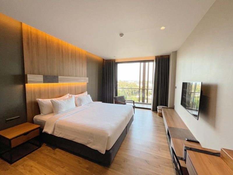
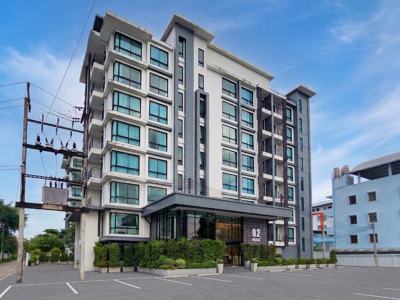
Where to Stay in Mae Sot in May
Hand-picked hotels across price tiers for May travellers.
Public Holidays in May
Dates that affect opening hours, transport and crowds
National Labor Day
Observed nationwide as a public holiday. Date calculated from the national holiday calendar.
National Labor Day
Observed nationwide as a public holiday. Granted in lieu when the holiday falls at a weekend. Date calculated from the national holiday calendar.
Coronation Day
Observed nationwide as a public holiday. Date calculated from the national holiday calendar.
Visakha Bucha
Observed nationwide as a public holiday. Date calculated from the national holiday calendar.
National Labor Day
Observed nationwide as a public holiday. Date calculated from the national holiday calendar.
Coronation Day
Observed nationwide as a public holiday. Date calculated from the national holiday calendar.
Visakha Bucha
Observed nationwide as a public holiday. Date calculated from the national holiday calendar.
Packing Checklist
Bookmark this page — your progress is saved between visits
Need the full list with shopping links?
Climate-specific gear, brand recommendations, and what to leave at home.
View Mae Sot Packing List →Essential Tips
Insider knowledge and common pitfalls to avoid
Insider Knowledge
The best mohinga in Mae Sot is served before 7am. Burmese tea shops near the central mosque prep their fish broth overnight. By mid-morning the day's batch is often finished. Sleep past eight and you have missed it. Set an alarm.
Mae Sot runs on Thai baht. Burmese kyat is accepted at the border market and some shops near the Friendship Bridge. The informal exchange rate is consistently poor. Use baht everywhere. Save yourself the mental arithmetic and the loss.
Afternoon rain in May follows a predictable pattern in the valley. Clouds build visibly over the Dawna Range by 1pm. First drops usually fall between 2pm and 4pm. Locals plan around this. Mornings are for errands and outdoor activity. Afternoons are for tea shops, naps, and indoor work. Follow their schedule. You will rarely be caught unprepared.
Mae Sot's night market on Prasat Withi Road brings together Thai, Burmese, Karen, Muslim, and Chinese communities over food. This convergence does not happen elsewhere in Thailand. The stall mix shifts nightly. The section near the mosque consistently has the most interesting Burmese and Indian-influenced dishes. Go hungry around 6pm. Work your way through.
Avoid These Mistakes
Do not assume you can cross into Myanmar on a whim. The Friendship Bridge is right there. Myanmar is visible across the river. The border crossing has faced unpredictable closures and restrictions since 2021. Travelers who build their entire Mae Sot itinerary around a Myanmar day trip risk losing a full day to a closed gate. Treat any crossing as a bonus. Never as a plan.
Do not drive to Umphang without respecting Highway 1090. The 1,219 curves are not a marketing gimmick. In May, wet roads and reduced visibility during rain squalls make this a demanding drive. It takes four to five hours one way. Travelers who underestimate it, on rented motorbikes with no mountain driving experience, end up in trouble. Hire a local driver. Or join an organized expedition.
Do not pack only for heat and forget the rain. May in Mae Sot is not dry-season Thailand. The 152 mm (6.0 inches) of rainfall arrives in concentrated bursts. Unpaved streets can flood within minutes. Travelers in sandals and tank tops with no rain gear and no waterproofing for their electronics learn this lesson expensively on day one. Pack smart.
Short on time? See day trips around Mae Sot on GetYourGuide.
Ready to plan your trip to Mae Sot?
Now that you've got the research covered, here's where to go next.
Explore More Activities in Mae Sot
Didn't see anything interesting yet?
Browse Viator's full catalog of tours, day trips, food experiences, and private guides in Mae Sot.
See All Mae Sot Tours on Viator